
Also available in Português
Hiking in the Azores: Best Trails Across the Islands
A local's guide to hiking in the Azores — the best trails on each island, the easy/medium/hard grading system, what to pack, and how to handle the weather.
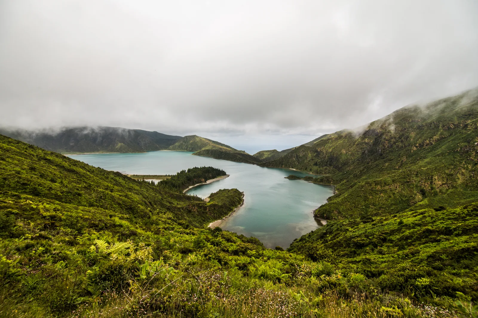
The Azores are, quietly, one of the best hiking destinations in Europe — and most people don’t know it until they arrive. I live on São Miguel and hike most weekends, and the thing I tell every visitor is the same: if you only drive to viewpoints, you’ve seen the Azores from the outside. The trails are how you get inside them.
This guide covers hiking across the whole archipelago — the trail grading system, the best routes on each island, what to pack, and how to handle the one variable that defines Azorean hiking: the weather.
Why the Azores are a hiker’s archipelago
The Azores are volcanic islands in the middle of the Atlantic, and that geography produces exceptional walking terrain: crater rims, caldera floors, coastal cliffs, laurel forest, levada-style water channels, and farmland laced with old footpaths.
Three things make hiking here stand out:
- A real trail network. The regional government maintains a large set of official, waymarked routes on every island.
- It’s uncrowded. Outside a couple of headline trails, you’ll often have the path to yourself — a rarity in European hiking.
- Variety in a small space. A single island can offer a gentle coastal stroll and a hard volcanic summit within a half-hour drive of each other.
- The trails go where roads don’t. The best of the Azores — hidden waterfalls, abandoned villages, crater floors, fajãs cut off below sea cliffs — is reachable only on foot. Drivers see the islands’ surface. Walkers see the rest.
The Azores trail grading system
Official Azorean trails are classified by the Regional Government of the Azores into three difficulty levels. The grading is dependable — worth trusting when you plan.
| Grade | What it means | Example |
|---|---|---|
| Easy | Flat or gentle, short to moderate distance, good footing | Faial Caldeira rim loop |
| Medium | Some climbing or descent, longer, occasional rough ground | Lagoa do Fogo descent |
| Hard | Long, steep, exposed, demands fitness and good weather | Climbing Pico, Faial Ten Volcanoes |
Trails are marked PR (Pequena Rota) with a number and island code, and waymarked with red-and-yellow stripes. A correct waymark means you’re on route. A red-and-yellow X means wrong way. Signposts at trailheads give distance, time, and grade.
Best hikes on São Miguel
São Miguel has the largest trail network and is where most visitors do most of their hiking. The full detail is in the best hikes on São Miguel guide — the highlights:
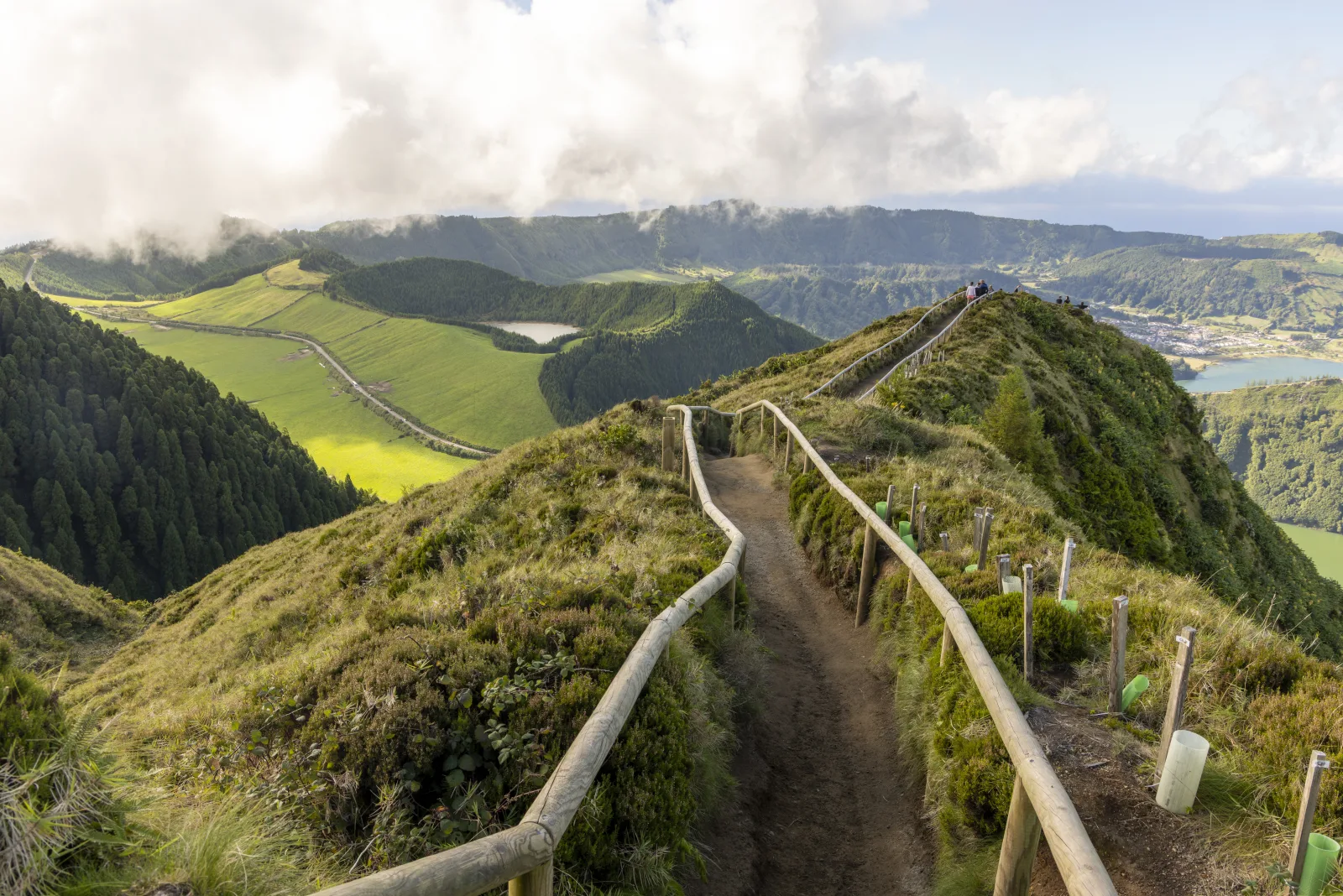
- Sete Cidades crater rim — the archipelago’s signature hike, along the ridge above the twin lakes. See the Sete Cidades guide.
- Lagoa do Fogo — the descent to the most pristine crater lake, covered in the Lagoa do Fogo guide
- Salto do Prego — a forest loop to a waterfall and the restored village of Sanguinho
- Janela do Inferno — a dramatic ravine viewpoint
- Coastal trails of the Nordeste — quiet cliff paths on the wild eastern end
São Miguel suits a hiker who wants variety without changing islands — easy crater rims and harder descents within the same week. A typical hiking day here might be a morning on the Sete Cidades ridge, lunch in a village below the crater, and an easy forest loop in the afternoon. The drives between trailheads are short, the trails are well-signposted, and you rarely need to commit a whole day to a single walk unless you choose to. That flexibility is why most first-time Azores hikers base themselves on São Miguel and never feel they’ve run out of ground.
Climbing Pico — the big one
The hardest and most famous hike in the Azores is the climb of Mount Pico — at 2,351m, Portugal’s highest mountain.
It’s a serious undertaking: a steep, rocky, fully exposed ascent that gains over 1,100m in about 3.5 km. Most climbers take 3–4 hours up and nearly as long down. The reward, on a clear day, is a view across the whole central group of islands from the roof of Portugal.
Key points:
- Register at the Casa da Montanha (the mountain house) before climbing — it’s mandatory and trackers are issued
- A guide is strongly recommended for anyone not experienced with mountain terrain
- The summit is cold and exposed even in summer — pack warm layers, gloves, a headtorch
- Only attempt it in a settled-weather forecast — the mountain makes its own cloud and conditions change fast
The full context is in the Pico Island guide.
Hiking on the other islands
Each island has its own walking character.
Faial
The Caldeira rim loop is a classic easy walk around the edge of the island’s central crater — 7 km, gentle, with views into a 2 km-wide volcanic bowl. The Ten Volcanoes traverse (Capelo to Capelinhos) is the hard option — 20 km across ten volcanic cones to the 1957 eruption site. See the Faial Island guide.
Flores
The wettest, greenest island has the archipelago’s best waterfall hikes — routes past the Poço da Alagoinha cluster of cascades and the dramatic western cliffs. Detailed in the Flores Island guide.
Terceira
Gentler walking through the Serra de Santa Bárbara and forest reserves, plus coastal paths. The island pairs hiking with its strong town and festival culture — see the Terceira Island guide.
São Jorge
The island of the fajãs — flat coastal shelves formed by lava flows and landslides, reached by steep descents from the central ridge. The classic route, the Fajã dos Cubres to Fajã da Caldeira de Santo Cristo trail, drops to a string of these shelves where a handful of families still live almost cut off from the rest of the island. It’s some of the most rewarding and least-crowded hiking in the Azores — and the descents are steep enough that strong knees and good boots earn their keep.
The smaller islands
Santa Maria, Graciosa, and Corvo all have short trail networks — quieter, lower-key walking for travellers already on those islands.
What to pack for hiking in the Azores
The Azorean climate is the thing to plan for. Pack for all of it:
| Item | Why |
|---|---|
| Waterproof jacket | Essential every season — rain is always possible |
| Hiking boots with grip | Trails are frequently muddy and uneven |
| Layers | Sun, wind, and fog can all happen on one hike |
| Water + snacks | Many trails have no facilities |
| Sun protection | The Atlantic sun is stronger than it feels |
| Offline map | Phone signal drops in craters and forest |
For Pico, add warm layers, gloves, and a headtorch. Whatever the trail, a fully waterproof jacket is non-negotiable — I carry one year-round.
One more thing on footwear: trail runners are fine for the easy graded routes in dry spells, but for anything medium or hard, or any trail after rain, proper boots with ankle support and aggressive tread are worth the bag space. The single most common reason I see visitors cut a hike short is footwear that can’t cope with Azorean mud. Bring the right boots and the islands open up — skimp on them and even an easy crater rim becomes a slow, cautious slog.
Hiking safety in the Azores
The Azores are not a dangerous place to hike, but the conditions catch unprepared visitors out. A few honest points:
- Mud is the real hazard. Most trail injuries here are slips, not dramatic falls. The volcanic soil holds water, and even “easy” trails can be slick. Boots with genuine grip matter more than they would in a drier climate.
- Fog disorients. When cloud drops onto a crater rim or a forest trail, visibility can fall to a few metres. This is when people lose the path. If you can’t see the next waymark, stop and reassess rather than pressing on.
- Coastal trails have exposed edges. Some cliff-top paths run close to long drops with no railing. In wind, give them respect, and keep children close.
- Tell someone your plan. For longer or harder routes, let your accommodation know where you’re going and when you expect to be back. Phone signal is unreliable in craters and on the far islands.
- Sunset comes fast. Build a daylight buffer — see the Azores time zone guide for sunrise and sunset hours by season.
None of this should put you off. Treated sensibly — good boots, an early start, respect for the fog — Azorean hiking is safe and hugely rewarding.
Building a multi-island hiking trip
You can’t hike between the islands, but you can build a trip that strings together the best of several. A strong hiking-focused route:
- São Miguel (4–5 days) — the widest variety: Sete Cidades, Lagoa do Fogo, the Nordeste coast
- Pico (2–3 days) — climb the mountain, walk the UNESCO vineyard trails along the coast
- Faial (2 days) — the Caldeira rim, and the Ten Volcanoes traverse for the fit
You move between islands by short flight or the Pico–Faial ferry. The 7-day multi-island itinerary shows how a route like this fits together. For a single-island hiking trip, São Miguel alone has more than enough to fill a week — see the 5-day São Miguel itinerary.
A hiking trip also pairs naturally with the islands’ other draws. A morning on the trail and an afternoon in a thermal pool is the local rhythm — and the reason your legs forgive you the next day.
Handling the weather
Azorean weather is the defining variable of hiking here. Three rules:
- Start early. Mornings are generally clearer. Craters and summits cloud over as the day warms.
- Check the forecast per location, not per island. Microclimates are real — it can be sunny at the coast and fogged-in at a crater rim 500m up.
- Have a backup. If the high trail is socked in, drop to a coastal or forest route. Don’t push a hard, exposed hike in poor visibility.
For the month-by-month picture, see best time to visit the Azores and Azores temperature by month. Daylight hours matter too — the Azores time zone guide covers sunrise and sunset.
And if you’d rather not match trails to your fitness, your islands, and the day’s weather yourself — Pocket Guide Azores is the AI travel planner that does exactly that, building a hiking itinerary around real conditions. Built by me, from São Miguel, on trails I walk most weekends.
The bottom line
Hiking is the best way to experience the Azores — not an add-on, but the main event of any good trip here. The graded trail network means there’s a route for every fitness level, from a flat crater rim to the climb of Portugal’s highest mountain. The scenery is volcanic and dramatic, the trails are uncrowded, and the only real thing you have to manage is the weather, which rewards an early start.
Pack a waterproof, start early, trust the grading, and pick trails that match the islands you’re visiting. Do that, and the Azores will give you some of the best walking in Europe — quiet, dramatic, and genuinely uncrowded in a way few places on the continent still are.
Guided versions of these trails are bookable online, which is the simpler option if you’d rather not sort out transport to the trailhead yourself:
What to do next
- Best hikes on São Miguel — the main island’s trails in detail
- Pico Island — climbing Portugal’s highest mountain
- Things to do in the Azores — hiking in the wider context
- Best time to visit the Azores — when to come for the best trail conditions
Frequently asked questions
Is the Azores good for hiking? +
Yes — the Azores are one of the best hiking destinations in Europe. The islands have a large network of official, well-marked trails crossing volcanic craters, coastal cliffs, laurel forest, and farmland. The terrain is dramatic, the trails are graded for all fitness levels, and because the archipelago is uncrowded you often have the path to yourself. Hiking is the single best way to see the islands.
How are Azores hiking trails graded? +
The Regional Government of the Azores classifies official trails into three difficulty levels — easy, medium, and hard — based on distance, terrain, and elevation. Trails are marked with red-and-yellow waymarks and signposted with the official PR (Pequena Rota) codes. The grading is reliable: an 'easy' trail genuinely is, and 'hard' trails deserve respect, especially in poor weather.
What is the best hike in the Azores? +
It depends on what you want. For the most iconic, the Sete Cidades crater rim on São Miguel is hard to beat. For a challenge, climbing Pico — Portugal's highest mountain at 2,351m — is the standout. For pristine scenery, the descent to Lagoa do Fogo. For something gentle and beautiful, the Faial Caldeira rim loop. Each island has its own signature trail.
Do you need a guide to hike in the Azores? +
For most trails, no — the official PR routes are well-marked and can be walked independently. The main exception is climbing Pico, where a guide (or at minimum registration at the mountain house) is strongly recommended because of the altitude, the exposure, and how fast the weather changes. Coasteering and canyoning always need a guided operator.
What should I pack for hiking in the Azores? +
Waterproof jacket (essential, every season), proper hiking boots with grip (trails are often muddy), layers for changeable weather, water, snacks, and sun protection. The Azores can deliver sun, fog, wind, and rain in a single hike, so pack for all of them. For Pico specifically, add warm layers, a headtorch, and gloves — the summit is cold even in summer.
When is the best time to hike in the Azores? +
May to September offers the most stable weather and the longest daylight, making it the prime hiking season. June and September are the sweet spot — good conditions without peak crowds. Hiking is possible year-round, but winter brings more rain, mud, and the chance of trails being closed by weather. Whatever the month, start hikes early — Azorean weather is generally clearer in the morning.
Is hiking in the Azores difficult? +
It can be as easy or as hard as you choose. The graded trail system means beginners and families have plenty of gentle, flat options — coastal paths, crater rims with little elevation change. Experienced hikers have serious challenges available, from the Pico climb to the long volcanic traverses on Faial. The terrain is rarely technical, but weather and mud make good footwear essential at every level.
Can you hike between the Azores islands? +
No — the islands are separated by open ocean, so hiking is island-by-island. But each island has its own trail network, and many travellers build a multi-island trip around hiking, pairing São Miguel's craters with Pico's mountain and Faial's volcanic traverses. You move between islands by short flight or ferry, then hike locally.