
Also available in Português
Santa Maria Island, Azores: A Local's Complete Guide
Santa Maria Azores explained by a local — white sand beaches, Praia Formosa, Pico Alto, Barreiro da Faneca red desert, and how to plan a Santa Maria trip.
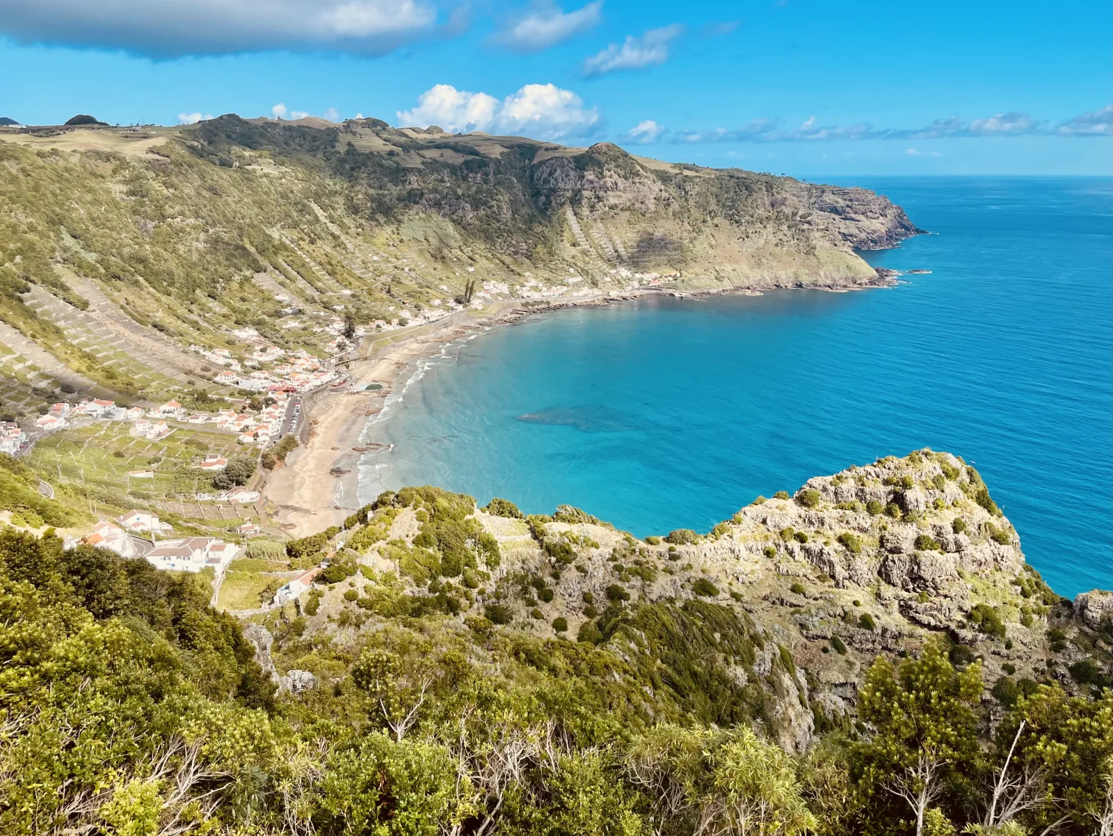
Santa Maria Azores is the warmest, driest, sandiest island in the archipelago — the one place where the word “beach” feels like a serious trip premise. Locals call it the “Algarve of the Azores,” and on a clear August afternoon at Praia Formosa, the comparison holds. White sand. 25°C ocean. Cliffs of terraced vineyards rising above the bay. None of which exists anywhere else in the islands.
Santa Maria sits 80 km south of São Miguel and gets a fraction of the visitor numbers — most travellers never see it, which is the whole point. I’ve spent enough time on Santa Maria to have opinions. This guide is the local breakdown of what’s actually there, what makes the island different from the rest of the Azores, and how to plan a Santa Maria trip.
If you’re still working out which Azores islands to visit, that prerequisite covers the geography. This one is Santa Maria specifically.
Where Santa Maria sits in the Azores
Santa Maria is the southernmost and easternmost of the nine Azorean islands, sitting in the Eastern Group alongside São Miguel. It’s small — 97 km² — and quiet, with around 5,600 people living mostly in and around Vila do Porto on the south coast.
The island is geologically the oldest in the Azores, about 8 million years old. This matters because:
- The volcano that created Santa Maria stopped erupting millions of years ago
- Wind and rain have eroded the high peaks into rolling hills
- White-sand beaches have formed naturally from limestone fragments — something the younger volcanic islands don’t have
- The climate is noticeably drier because there are no tall peaks trapping moisture
The geographic logic divides into three zones:
- South coast — Vila do Porto (main town + airport), Praia Formosa (the famous beach)
- North coast — São Lourenço Bay, Anjos (Columbus landing), Maia
- Interior — Pico Alto, Barreiro da Faneca red desert, rural villages
You can drive across Santa Maria in 30 minutes. Most attractions sit within 20 minutes of Vila do Porto.
Why Santa Maria is called the “Algarve of the Azores”
Three things make Santa Maria distinctly warmer than the rest of the archipelago:
1. The climate is 1-2°C warmer year-round and 30-40% drier. Santa Maria gets around 700-800 mm of annual rainfall vs São Miguel’s 1,010 mm. Summer highs reach 26-28°C, which is rare elsewhere in the Azores.
2. White-sand beaches actually exist. The island’s geological age means natural calcareous sand has accumulated on the south coast. Praia Formosa is the largest sand beach in the entire Azores archipelago — there’s nothing comparable on São Miguel, Pico, Faial, or Terceira.
3. The vibe is laid-back beach-town. Vila do Porto in August feels closer to Lagos or Tavira (Algarve) than to Ponta Delgada — open seafront cafés, beach umbrellas, kids in swimwear. Most other Azorean islands are too cool and rainy to support that pattern.
If beach time is part of your Azores trip, Santa Maria is the move. For broader weather context, the Azores temperature by month guide covers seasonal patterns across all islands.
Praia Formosa: the largest beach in the Azores
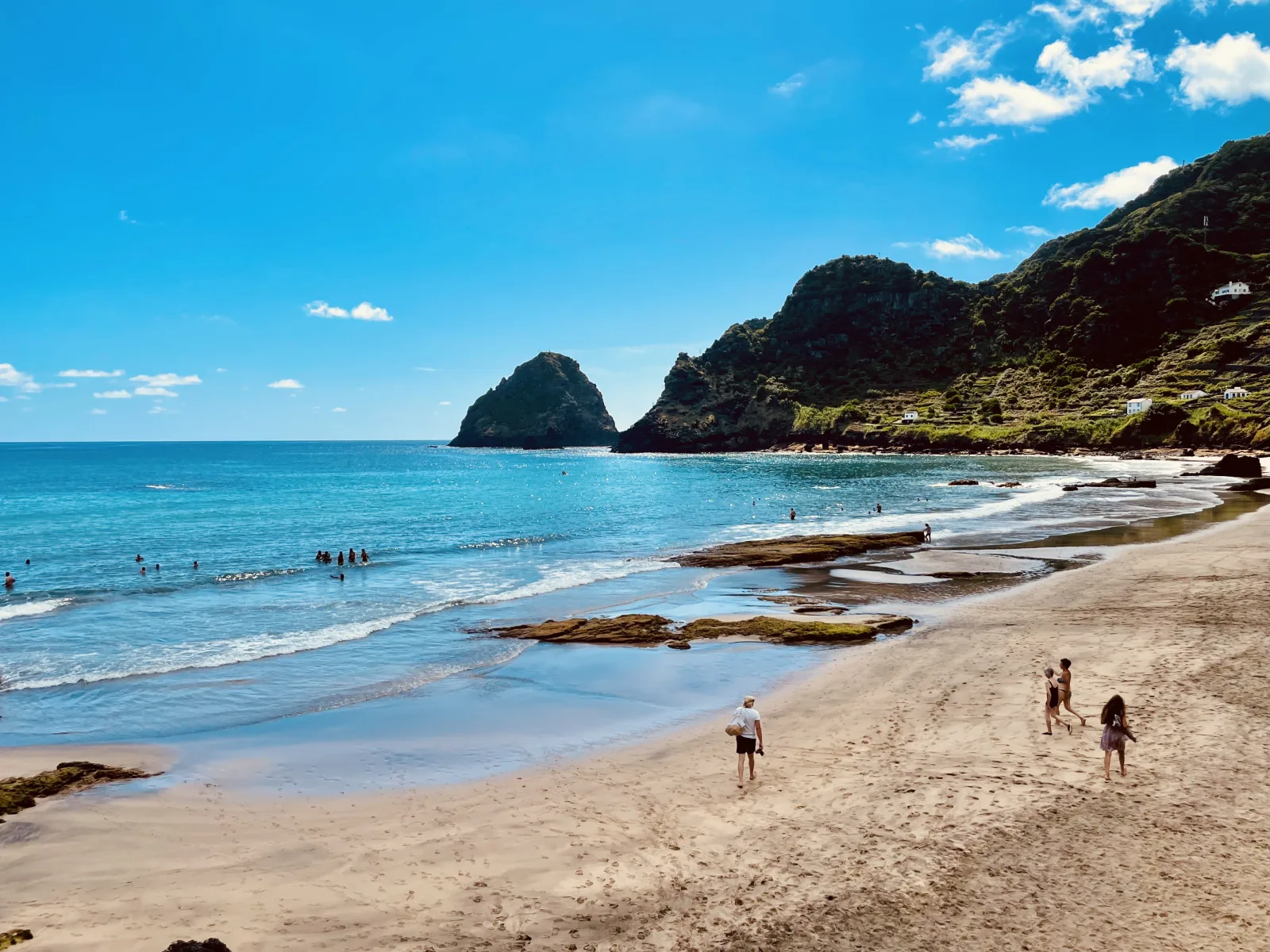
The single best-known sight on Santa Maria. Praia Formosa (“Beautiful Beach”) is a 1-km curve of golden sand on the south coast, 10 minutes from Vila do Porto.
| Detail | Value |
|---|---|
| Length | ~1 km |
| Sand | Golden / cream calcareous |
| Water temp summer | ~25°C (warmer than other Azorean beaches) |
| Surf | Manageable, mostly calm |
| Facilities | Showers, lifeguards (summer), beach bar, parking |
| Best months | June-September |
| Notable | The Guardian top-20 world beaches (2013) |
The water is warmer than at other Azorean beaches because calcareous particles in the sand warm faster than dark volcanic sand. Locals swim here year-round — even January water at Praia Formosa runs warmer than at the volcanic-rock beaches elsewhere.
If you’re on Santa Maria in early-to-mid August, this is also where the Maré de Agosto music festival happens — international acts on a stage 20 metres from the surf, the most distinctive music event in the Azores.
São Lourenço Bay: the amphitheatre coast
The most photographed landscape on Santa Maria. São Lourenço Bay is a perfectly arc-shaped bay on the northeast coast — the kind of natural amphitheatre that looks computer-generated.
What makes it striking:
- White sand crescent beach at sea level
- Terraced vineyards rising up the cliffs in concentric rings, separated by grey stone walls
- Smaller white houses scattered through the terraces
- Clear turquoise water in the protected bay
The viewpoint above the bay (Miradouro de São Lourenço) is where every postcard photo of Santa Maria gets taken. Best at mid-morning when the light hits the terraces.
You can also drive down to the bay itself for swimming — but the road is steep and the parking limited. Most visitors photograph from above and swim at Praia Formosa instead.
Barreiro da Faneca: the Red Desert
A completely unexpected landscape on the north of Santa Maria. Barreiro da Faneca is a “red desert” — a vast reddish-orange clay plain spread across ancient lava flows, formed when iron-rich volcanic minerals weathered into clay over millions of years.
| Detail | Value |
|---|---|
| Landscape | Reddish-orange clay, almost no vegetation |
| Status | Protected landscape area |
| Trails | Marked walking paths |
| Best photo time | Late afternoon (warm light) |
| Comparison | Mars / Atacama Desert in miniature |
| Why it stands out | The only landscape like this in the Azores |
The combination of red ground, green Atlantic Ocean visible from the cliffs, and absolute silence makes Barreiro da Faneca one of the most distinctive walks in the archipelago. Most visitors miss it entirely — it’s not on the typical Santa Maria itinerary, but it’s worth half a day.
Pico Alto: the 360° viewpoint
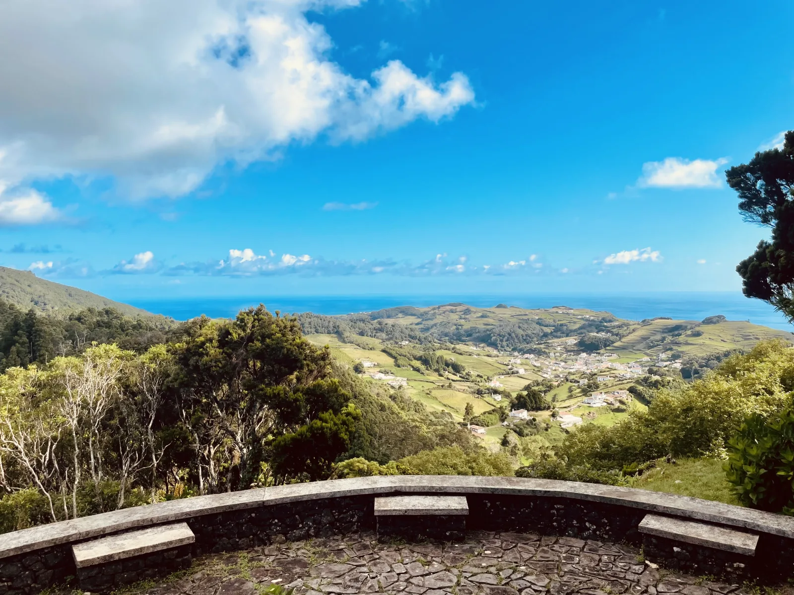
Pico Alto is the highest point on Santa Maria at 590 metres. A short drive from Vila do Porto reaches the parking area near the summit, with a marked viewpoint trail.
On clear days, the view from the top includes:
- The entire shape of Santa Maria — south coast to north coast
- São Miguel to the north, including Pico da Vara if the air is exceptionally clear
- The terraced vineyards of São Lourenço Bay below
- Praia Formosa to the southwest
The microclimate effect is real — Pico Alto sometimes has localised cloud even when the rest of the island is clear. Visit on calm clear afternoons for the best odds of unobstructed views.
For broader Azorean microclimate context, elevation effects matter more on Santa Maria than on São Miguel because the island is smaller and the high point is lower.
Anjos: where Columbus first set foot in Europe
A small port on Santa Maria’s north coast with surprising historical weight. Anjos is the documented site where Christopher Columbus’s caravel Niña made landfall on February 18, 1493, returning from his first transatlantic voyage.
The story: Columbus’s expedition was caught in a violent storm on the return crossing. His ship sought shelter at Santa Maria. He went ashore at Anjos and visited the small chapel — Ermida de Nossa Senhora dos Anjos — to give thanks. The chapel still stands. A monument marks the landing spot.
For history-minded visitors this is a real point of interest — one of the few documented 1493 landfall sites still visitable. For everyone else, it’s a quiet picturesque port, worth 30 minutes on a coastal drive.
Where to stay on Santa Maria
The three main accommodation zones:
| Area | Pros | Cons |
|---|---|---|
| Vila do Porto | Most hotels, restaurants, walking distance to ferry/airport bus | South coast, away from São Lourenço |
| Around Praia Formosa | Beach access, summer holiday vibe | Limited dining options |
| Rural interior (Santo Espírito, Almagreira, Lagoinhas) | Quiet, authentic, turismo rural | Need a car for everything |
Solid mid-range options in Vila do Porto:
- Hotel Colombo — outdoor pool, gym, central location, ~€90-€140/night
- Charming Blue — Palladian building in an English-style botanical garden, ~€120-€180/night
Rural / turismo rural:
- Casa da Avó in Santo Espírito — traditional rural house in a small village
- Casa de Lagoa in Lagoinhas — holiday home in the north
Booking note: Santa Maria has limited inventory compared to São Miguel, but more than Flores. Book 1-2 months ahead for July-August, walk-ups workable in shoulder season. For broader hotel-zone strategy, see the where to stay in São Miguel guide.
How to get to Santa Maria
SATA Air Açores runs frequent inter-island flights between São Miguel (PDL) and Santa Maria (SMA) — typically 2-3 flights per day, about 25 minutes in the air on the Bombardier Dash 8. SATA also operates direct flights from Lisbon to Santa Maria (around 2h 30m) on the Airbus A320, though most international travellers connect via PDL.
| Route | Operator | Frequency | Flight time |
|---|---|---|---|
| Ponta Delgada (PDL) → SMA | SATA Air Açores | 2-3x daily | ~25 min |
| Lisbon (LIS) → SMA | SATA Azores Airlines | Several per week | ~2h 30m |
Santa Maria Airport (SMA) sits 5 km from Vila do Porto. From the airport you can:
- Bus to Vila do Porto — runs roughly hourly during the day
- Taxi — 10-minute ride, ~€10-€12
- Rental car — 4 operators (Hertz, Avis, Europcar, local) have desks in the terminal
The airport has the second-longest runway in the Azores (3,049 metres) because Santa Maria Airport was used as a transatlantic refueling stop for early international flights between Europe and the Americas. The runway is much bigger than the modern passenger traffic warrants. For full inter-island context, see the Azores airport guide and how to get to the Azores.
How many days for Santa Maria
A practical breakdown:
| Trip length | What fits | Notes |
|---|---|---|
| 1 day (day trip from PDL) | Praia Formosa + São Lourenço viewpoint | Rushed |
| 2 days | Above + Pico Alto + Barreiro da Faneca | Good for a beach add-on |
| 3-4 days | Slower pace, smaller villages, Anjos historic walk | Comfortable depth |
| Full week | + diving, Maré de Agosto festival, repeat beach days | If festival or diving is the draw |
For broader trip-length planning across the archipelago, the how many days in the Azores guide covers multi-island combinations.
My recommendation: Santa Maria works best as a 2-day add-on to a São Miguel trip. The 25-minute flight makes it logistically simple, and 2 days fits all the headline sights without rushing.
Diving on Santa Maria
Worth a separate note. Santa Maria’s warmer water (~22-24°C summer, ~18°C winter) and southern position make it the warmest dive water in the Azores. Top dive sites include:
- Ambrósio Reef — pelagic species, occasional manta rays
- Dollabarat Bank — open-water seamount, advanced divers
- Maia coastline — easier dives, good visibility
For the broader Azorean diving context — Princess Alice Bank, blue sharks off Pico, dive operators — see the scuba diving Azores guide. Santa Maria is the warm-water specialist island. Pico is the volcanic-topography specialist. Faial is the wreck specialist.
Common mistakes when planning a Santa Maria trip
1 — Trying to do Santa Maria as a single-day trip from São Miguel. Doable but rushed. Two days is the floor.
2 — Skipping Barreiro da Faneca because it’s not on the standard itinerary. It’s one of the most distinctive landscapes in the Azores. Don’t skip it.
3 — Booking summer accommodation last-minute. July-August fills up, especially during Maré de Agosto week (mid-August). Book 1-2 months ahead.
4 — Assuming “Azores” means “rainy.” Santa Maria has the driest climate in the archipelago. Pack sunscreen and beach clothes alongside the waterproof.
5 — Combining Santa Maria with Flores or Corvo. The Eastern Group and Western Group are 600 km apart geographically. Pair Santa Maria with São Miguel — and pair Flores with Faial or central islands instead.
6 — Driving the whole island in one day. You can — the island is small enough. But the slow pace is the point. Drive less, swim more, eat slower.
If you’d rather have a Santa Maria trip built into a multi-island Azores plan with the flights, ferries, and beach timing handled automatically, Pocket Guide Azores does that with local knowledge built in.
The bottom line
Santa Maria Island, Azores is the warm-water island. Different from the rest of the archipelago: drier, sandier, older, slower. White sand beaches that don’t exist anywhere else in the Azores. The driest climate of the nine islands. A “Red Desert” landscape that looks Martian. Plus a small piece of European history (Columbus, 1493) that history buffs love.
Not for first-time Azores visitors with 5 days — São Miguel does more on a tight budget. Worth 2-3 days for trips of 7+ days where you want a different texture from the volcanic green of São Miguel. The local move for travelers who like a Mediterranean-style beach day alongside their volcanic island exploration.
Tours and day trips on the island, bookable ahead — worth sorting early, because inventory here is thinner than on São Miguel and the good trips fill first:
What to read next
- Azores map and island names — where Santa Maria fits in the archipelago
- Things to do in the Azores — the archipelago-wide roundup of experiences
- Best beaches in São Miguel — for the São Miguel beach comparison
- Azores temperature by month — why Santa Maria is the warmest island
- Scuba diving the Azores — Santa Maria’s warm-water dive sites
- How to get to the Azores — flight context including SMA
Frequently asked questions
Where is Santa Maria Island in the Azores? +
Santa Maria sits in the Eastern Group of the Azores, alongside São Miguel. It's the southernmost and easternmost of the nine islands, roughly 80 km south of São Miguel. The island is small (97 km², population around 5,600) with the main town and airport at Vila do Porto on the south coast. Santa Maria is geologically the oldest Azorean island (about 8 million years), which means it's flatter, more eroded, and has the more developed white-sand beaches missing from the volcanic younger islands.
How do I get to Santa Maria Azores? +
By plane only. SATA Air Açores operates daily inter-island flights from Ponta Delgada (PDL) to Santa Maria (SMA) — flight time around 25 minutes. SATA also runs occasional direct flights from Lisbon to Santa Maria, but most international travellers connect via PDL on São Miguel. The airport is 5 km from Vila do Porto with regular buses, taxis (10-min ride), and car rental desks. Santa Maria Airport (SMA) has the second-longest runway in the Azores — historically a transatlantic refueling stop.
Why is Santa Maria called the 'Algarve of the Azores'? +
Because of the white-sand beaches, hotter and drier climate, and laid-back beach-town atmosphere — closer to the southern coast of mainland Portugal than to the wet volcanic green of São Miguel. Santa Maria averages 1-2°C warmer year-round than the rest of the archipelago, gets 30-40% less rain, and is the only Azorean island where 'beach holiday' is a viable trip premise. Praia Formosa was rated by The Guardian as one of the 20 best beaches in the world in 2013.
What are the best Santa Maria beaches? +
Three stand out. Praia Formosa — the largest sand beach in the Azores, on the south coast near Vila do Porto, golden sand, water around 25°C in summer thanks to calcareous particles that warm faster. São Lourenço Bay — a stunning amphitheatre-shaped bay on the northeast coast with white sand, terraced vineyards rising up the cliffs, and one of the most photographed coastlines in Portugal. Anjos — historic small beach where Columbus first set foot in Europe on his return from America in 1493. Plus several smaller coves at Maia and Praia do Norte for quieter swims.
What is the highest point on Santa Maria? +
Pico Alto, at 590 metres. A short drive from Vila do Porto takes you to the summit, with a 360-degree panoramic view of the entire island plus, on clear days, São Miguel to the north. There's a small parking area and a marked viewpoint. The microclimate at Pico Alto can produce localised cloud even when the coast is sunny — visit on clear afternoons for the best views.
What is Barreiro da Faneca? +
Santa Maria's 'Red Desert' — a striking reddish-orange clay landscape on the north of the island, formed from ancient lava flows that weathered into iron-rich clay minerals. The landscape looks Martian: barren, deep-orange ground spread across rolling hills, with almost no vegetation. It's a protected area with marked walking trails. Best photographed in late afternoon when the warm light intensifies the colour. Unlike anywhere else in the Azores.
Did Christopher Columbus stop at Santa Maria? +
Yes — on his return voyage from his first transatlantic crossing in February 1493, Columbus's caravel Niña stopped at Anjos, a small port on Santa Maria's north coast. It's recorded as the first European land he touched after America. There's a small chapel at Anjos (Ermida de Nossa Senhora dos Anjos) that he supposedly visited, and a monument marks the spot. For history-minded visitors, Anjos is one of the few documented 1493 landfall sites still visitable today.
How many days for a Santa Maria trip? +
Two to three days is the sweet spot. Two days fits Praia Formosa, São Lourenço Bay, Pico Alto, and Barreiro da Faneca. Three days adds slower beach time, the Anjos historic walk, the smaller coves, and the rural villages (Santo Espírito, Almagreira). A full week makes sense if your trip overlaps with the Maré de Agosto music festival or you're combining Santa Maria with diving — the warm-water diving is some of the best in the Azores. For most multi-island trips, 2 days as an add-on to São Miguel works.