
Also available in Português
São Miguel Self-Drive: The Complete Road Trip Route
The complete São Miguel road trip route by a local — where to stop, what order to visit, and the scenic loops most rental car tourists never find on their own.
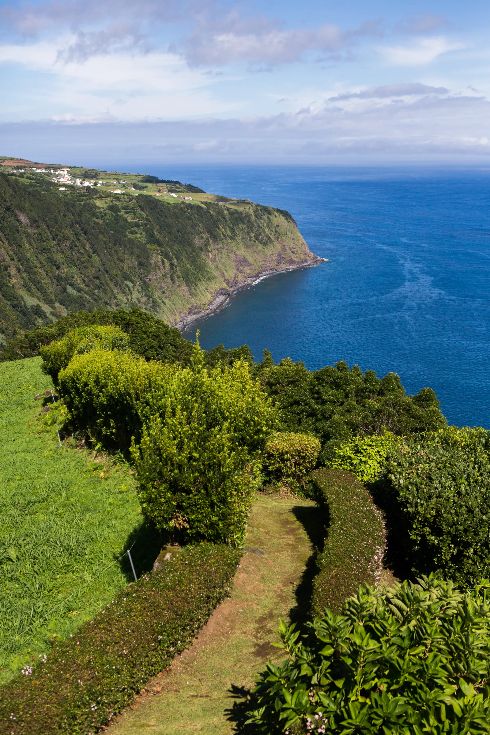
A São Miguel road trip is the single best decision most visitors make — and then half of them waste it by following the same two-stop route every minibus on the island runs. The island is small enough to drive in a day and dense enough that a proper circuit takes two. There’s a specific order that makes the light work, keeps you ahead of the tour buses, and gets you to the viewpoints before the clouds close in. Most tourists piece it together on day four. This is what you want on day one.
I live here. I’ve driven every road on this island more times than I can count, including the hairpin to Sete Cidades in fog thick enough to park in. What follows is the route I’d hand to someone who just picked up their rental from the airport desk and has no idea what to do next.
Before Your São Miguel Road Trip: Pick Up the Keys
The car rental agencies at Ponta Delgada airport are the obvious first stop, and the desks here are competitive on price. Book at least a week in advance if you’re arriving in peak season (June–September) — inventory genuinely runs thin in August. A compact car handles fine on most island roads. If you’re planning the north coast miradouros or the steeper interior approaches, a small SUV makes those sections more comfortable.
A few things to sort before you leave the parking lot:
- Download offline maps. Google Maps works well, but signal drops on several highland sections between Sete Cidades and Lagoa do Fogo. Download the São Miguel area to your phone before leaving the airport. Apple Maps offline works too.
- Full tank, full insurance. There are no breakdown services in the volcanic interior. Full insurance — including the optional tyre and undercarriage cover — is worth the extra €8/day given how rough some of the crater access roads get.
- A note on speed limits. Fifty km/h in towns, 90 km/h on the EN-1A coast roads, 50 km/h on mountain roads. The bends enforce this better than any sign.
The island drives on the right, with international signage. Azorean drivers are calm. The occasional cow wandering across a highland road is the real hazard — it happens, and it’s not a metaphor.
The Route: Anti-Clockwise Is the Right Answer
Most driving guides tell you to “just loop around the island.” They don’t explain why the direction matters. It does.
Anti-clockwise — starting west toward Sete Cidades, cutting through the interior toward Lagoa do Fogo, dropping to Furnas in the east, then returning west along the south coast — gives you four real advantages:
- You hit Sete Cidades in the morning, when the viewpoints face east into rising light and before tour buses arrive from Ponta Delgada (they leave around 9:30 AM).
- You cross Lagoa do Fogo mid-morning, which is statistically the clearest window on most days.
- You arrive in Furnas around noon — exactly when the cozido das furnas pots are opened for lunch.
- The south coast return in late afternoon puts the low sun behind you, not in your eyes.
Here’s the full circuit at a glance:
| Leg | Route | Distance | Main stop |
|---|---|---|---|
| 1 | Ponta Delgada → Sete Cidades | 25 km, 40 min | Vista do Rei, caldera rim |
| 2 | Sete Cidades → Lagoa do Fogo | 35 km, 55 min | Lagoa do Fogo miradouro |
| 3 | Lagoa do Fogo → Furnas | 30 km, 40 min | Caldeiras + cozido lunch |
| 4 | Furnas → Ponta Delgada (south coast) | 55 km, 55 min | Ribeira Quente beach |
| Total | 145 km | ~3.5h driving |
That’s 3.5 hours of pure driving, but the stops add 5–7 hours on top. This is a full day. If you want to explore each stop properly — and you should — split this across two days. Day 1 west and interior — Day 2 east and return.
The West: Sete Cidades
Sete Cidades is the top of the priority list for good reason — two crater lakes, one blue and one green, sitting inside a caldera you can see from the rim. The question isn’t whether to go — it’s which viewpoints to hit and in what order.
Vista do Rei is the classic shot: standing on the crater rim looking down at both lakes separated by a narrow bridge. Most people stop here, take the photo, and leave. That’s the mistake. The road continues along the crater rim to Miradouro da Boca do Inferno, which gives you a wider angle with a fraction of the crowd, and then down the ER-9 switchbacks into Vila das Sete Cidades village itself. The village is a 20-minute stop — walk along the lake’s edge, have a coffee at the café that opens most mornings, and see what the scale looks like from the bottom rather than above.
The cloud rule for Sete Cidades: Be there before 10:00 AM on most days. By 11:00 on overcast days, low cloud rolls in from the north and fills the caldera. This is a year-round pattern. The backup rule: if you arrive and it’s fogged in, don’t leave immediately. Caldera cloud here is unstable — it can lift briefly, give you a sudden open view, then close again. Wait 20–30 minutes. If it’s still locked in after that, go down into the village, which is usually clear even when the rim is clouded.
| Viewpoint | Drive from Ponta Delgada | Best for | Crowd level by 10 AM |
|---|---|---|---|
| Vista do Rei | 35 min | Classic twin-lake shot | High |
| Miradouro da Boca do Inferno | 40 min | Wider crater rim, dramatic angles | Low |
| Miradouro Cerrado das Freiras | 42 min | Aerial view, road less driven | Very low |
| Vila das Sete Cidades village | 45 min | Scale, café, lake-edge walk | Very low |
I’d recommend hitting Boca do Inferno first (it’s on the way in from the north), then Vista do Rei, then dropping into the village before leaving. Allow 90 minutes total if you’re moving at a good pace.
The Sete Cidades guide has the full breakdown of the crater hiking options and what to do if you have an entire day here.
The Interior: Lagoa do Fogo
Lagoa do Fogo — the Fire Lake — sits in its own caldera in the center of the island. It’s technically São Miguel’s most pristine lake: no motorboats, minimal development, a protected nature reserve. It’s also the most cloud-prone stop on the whole circuit, which is why timing matters more here than anywhere else.
From Sete Cidades, the ER-5 cuts east across the volcanic plateau. The road is well-surfaced and clearly signed but climbs to around 500m, and mobile signal disappears on most of this stretch. The miradouro at the top has a parking area and a viewpoint looking straight down into the lake.
The rule here is strict: if it’s fogged in at the parking area, the lake is fogged in. Unlike Sete Cidades, the Lagoa do Fogo caldera doesn’t clear quickly — if it’s closed, come back at a different time or on a different day. Morning visits before 11:00 AM catch it clear on most non-rainy days. June and July have the best odds by a margin. November through February, factor in that you may find cloud cover on any given morning — it’s real, it’s not an edge case.
There’s a 45-minute loop trail from the viewpoint down to the lake shore. Do it if you have time — the lake from the bottom looks entirely different from the rim perspective, and the trail passes through protected heath vegetation that doesn’t look like anything else on the island.
The Lagoa do Fogo guide covers the hike detail, difficulty rating, and the best time of year to visit.
The East: Furnas Valley
Furnas is the day’s emotional peak. It’s a village in a volcanic valley where the ground steams, lunch is cooked in geothermal pots buried underground, and the afternoon bath is in iron-rich thermal water the color of strong tea. You cannot rush Furnas. Plan 3–4 hours minimum.
Arrive by noon. The cozido das furnas is served at lunch, and the pots in the caldeira field are opened around 12:00–12:30. You need to be seated by 12:15 at the latest. Restaurante Tony’s and O Milho are the two most respected options for this meal — reserve the night before. The dish itself takes 45 minutes: slow-cooked meat, sausage, and vegetables from the underground heat, €15–18 per person. This is the local move. The cooking method genuinely produces a different result from anything done above ground.
After lunch, two stops are non-negotiable:
Caldeiras das Furnas — the natural fumaroles and boiling mud pools, a short walk from the restaurant area. Free to visit, no ticket needed, and genuinely unusual in a European context. The smell hits you before you see the steam.
Parque Terra Nostra — a 12-hectare botanical garden built around a large geothermal pool. Entry is €6.50 for the garden — €9 if you want to bathe in the pool. The pool holds around 39°C, has a strong iron-sulfur smell that you stop noticing after 10 minutes, and a color somewhere between orange and rust. I’d do it once. It’s earned.
The Furnas guide is the deep dive: caldeiras, restaurant details, hotel recommendations, and how to build a proper half-day or full day here.
The South Coast Return
From Furnas, the EN-1A runs west along the south coast back to Ponta Delgada — roughly 55 km and about an hour of driving. Most guides treat this as a transit leg. It isn’t.
Three stops worth making:
Ribeira Quente — a small fishing village with the island’s most sheltered black-sand beach. The water here is geothermally warmed from below, significantly warmer than the open Atlantic water on the north coast or west side. In summer it fills with locals. In shoulder season, you may have it to yourself for an hour. It’s 10 km off the main EN-1A via the ER-4 — don’t skip it.
Miradouro do Salto do Cavalo — a roadside viewpoint on the south coast between Furnas and Água de Alto. Looks back east toward the Furnas valley. Brief stop, five minutes, good shot.
Água de Alto beach — the island’s longest sandy beach, with cafés and a decent afternoon swim if you want to end the circuit on the water before returning to Ponta Delgada. Calmer swell than the north coast, more families, parking right off the road.
The south coast EN-1A runs fast and smooth. Allow 45 minutes even with these stops.
The North Coast: The Road Most People Skip
Most visitors do the circuit above and call it done. If you have a second day — and you should — the north coast is where you find the São Miguel that doesn’t appear on most itineraries.
Caldeira Velha is the one non-negotiable stop: a waterfall-fed thermal pool in a forested ravine, surrounded by tree ferns that look like something from a Jurassic set. It’s on the ER-9 north of Ribeira Grande, clearly signposted. Entry is €5. The pool is small — it gets crowded by mid-morning on weekends. Arrive before 10:00 AM on a weekday and you’ll have it nearly to yourself.
Ribeira Grande — the island’s second-largest town, and the least touristed. The historic center around the Câmara Municipal has a genuine coffee scene and a Friday fish market that locals actually use. Worth 20 minutes.
Nordeste — the northeastern corner, a dramatic coastline with sea stacks, a lighthouse road, and farming villages where hydrangeas line the verges and almost no tourist vehicle appears before noon. The drive itself is the point: tight cornering roads through the island’s oldest agricultural land, Atlantic cliffs dropping away at intervals, and the sense that you’ve found the São Miguel that Instagram hasn’t processed yet.
If you’re doing the north coast as a second day, start from Ponta Delgada heading east on the north coast EN-1A variant, stop at Caldeira Velha, push to Nordeste for lunch, then return via the interior or straight south on the ER-2. About five hours driving and stops.
The 2-Day Breakdown
For most visitors with a rental car and a full two days, this is the sequence that works:
| Day | Route direction | Key stops | Total driving |
|---|---|---|---|
| Day 1 | West → interior → east | Sete Cidades viewpoints, Lagoa do Fogo, Furnas caldeiras + lunch, Terra Nostra pool | ~3.5h |
| Day 2 | East → north coast → return | Caldeira Velha thermal pool, Ribeira Grande, Nordeste lighthouse road | ~4h |
Day 1 covers the classic highlights. Day 2 is what separates the people who came to São Miguel from the people who understood it.
The 5-day São Miguel itinerary builds this driving route into a full trip structure with hotel base recommendations and logistics for each night.
The Bottom Line
São Miguel is one of the few places where renting a car genuinely transforms the trip rather than just making it more convenient. The difference between the tour bus and the rental car is not just flexibility — it’s access to a different version of the island. The cove below Boca do Inferno, the Nordeste lighthouse road at 8:00 AM, Ribeira Quente beach before the families arrive — none of these fit into a guided tour schedule.
The honest truth is that this island rewards the driver. Every miradouro that’s “a short detour” from the main circuit becomes something you actually stop at. Every village that looks interesting from the main road becomes a five-minute side trip instead of a regret.
Two days is the minimum for the full circuit. Three is better — it lets you stay longer at Furnas and adds the north coast without rushing anything. If you’re still working out whether you need a car at all, the do you need a car in the Azores guide has the full picture on transport options and when a car is and isn’t worth it.
Rent the car. Drive anti-clockwise. Be at Sete Cidades before 10.
Guided options around here, if you’d rather not piece the logistics together yourself:
What to Read Next
- The Sete Cidades guide — what to do if you have a full day at the crater, including the hiking options most visitors miss
- The Furnas guide — caldeiras, cozido restaurant details, and whether Terra Nostra is worth the entry price
- The Lagoa do Fogo guide — the hike down to the lake shore and the best season for clear views
- 5-day São Miguel itinerary — the full trip structure built around this driving route
- São Miguel viewpoints — the miradouros worth pulling over for along the route
And if you’d rather not build this route yourself, Pocket Guide Azores generates weather-aware, day-by-day driving itineraries that account for cloud forecasts at Sete Cidades and Lagoa do Fogo, your specific hotel location in Ponta Delgada or Furnas, and the stops you care about most — so you can focus on driving the island, not planning it.
Frequently asked questions
Do I need a car to explore São Miguel? +
Yes. Public transport outside Ponta Delgada is limited to a few slow inter-city buses. To reach Sete Cidades, Furnas, Lagoa do Fogo, or the north coast on your own schedule, a rental car is essential. Without one, you're dependent on guided tours that rarely let you stay as long as you want.
How long does it take to drive around all of São Miguel? +
The island is roughly 65 km long and 15 km wide. A complete circuit without stops takes about 2.5 hours of driving. With proper stops at Sete Cidades, Lagoa do Fogo, and Furnas, plan 2 full days. One day is technically possible but leaves you rushing every stop.
What size car should I rent in São Miguel? +
A compact or small SUV works for most roads. A few access roads — particularly down to Sete Cidades village and some north coast miradouros — are narrow, but nothing requires 4WD. An SUV gives you peace of mind on the steeper hairpin sections. Avoid large vans or people carriers.
Is driving in São Miguel difficult for foreigners? +
Not particularly. Roads are in decent condition, signage is in Portuguese but clear, and local drivers are calm. The challenge is navigation on highland volcanic roads where mobile signal can drop. Download offline maps before leaving Ponta Delgada. The approaches to Sete Cidades and Furnas both have steep, winding sections.
Are there tolls on São Miguel? +
No tolls on São Miguel. Fuel prices are similar to mainland Portugal. Budget roughly €40–60 for fuel across a full 2-day island circuit, depending on your car and how much backtracking you do.
Can I do a São Miguel road trip in one day? +
Only if you pick two stops, not the whole island. Sete Cidades in the morning and Furnas in the afternoon is the classic one-day drive — roughly 130 km and 4 hours of driving total. Adding Lagoa do Fogo and the north coast on the same day means rushing everything.
Should I drive clockwise or anti-clockwise around São Miguel? +
Anti-clockwise is better. Start with Sete Cidades in the west, cut through the interior to Lagoa do Fogo, drop down to Furnas in the east, then return along the south coast. This sequencing gets you the best light at the main viewpoints and keeps you ahead of the tour buses.
Can I rent an electric car in São Miguel? +
Some agencies now offer EVs, and Ponta Delgada has public charging near the marina. For a full island circuit with highland roads, check the range carefully before committing. A petrol car is the lower-risk option for a full loop, especially in winter when heating cuts range significantly.